Astronomer Carl Sagan described Earth as a “pale blue dot.” From a great distance, in space, this may be true, but zoom in a bit more and you'll see vibrant greens and rich reds, as well as shallow oceans and rugged terrains. Mother Nature is an artist, and the ultimate proof is the endless supply of aerial images taken by the European Space Agency (ESA). These photos allow us to marvel at the wonders of the world from a fresh, celestial perspective.
Over the years, satellite images have been taken by Earth observation missions Copernicus Sentinel-1, Copernicus Sentinel-2, and Copernicus Sentinel-3—all developed and operated by the ESA. Fitted with a suite of cutting-edge instruments, these missions take high-resolution images of the Earth's surface to monitor large-scale global dynamics and provide valuable insights regarding the weather and vegetation. Luckily, at the same time, they have also provided us with breathtaking sights.
From the green tints of the Ganges River to a Gustav Klimt-like composition of fields in Texas, the landscapes captured in these images range from monochromatic yet textured lands to complex, multi-hued locations packed with details. They includes bicolor composition that evoke organic motifs, like a yellow-blue photo of East Kalimantan, Borneo—which also seems to resemble a leaf under a microscope.
Like any proficient artist, Mother Nature is not all about color, but shape and shading as well. Even mostly all-white compositions shot in high mountainous areas or snowed-in sceneries, are equally breathtaking. One of the best examples of this is the ESA's picture of the world's biggest iceberg, A23a. At twice the size of London, it stands out in the middle of a cloud-covered ocean.
To stay up to date with the marvelous satellite images taken by the agency, follow ESA Earth on Instagram. To browse even more shots and learn about the missions capturing them, make sure to pay a visit to the European Space Agency's website.
Take a look at 15 images of Earth from space shared by the European Space Agency.
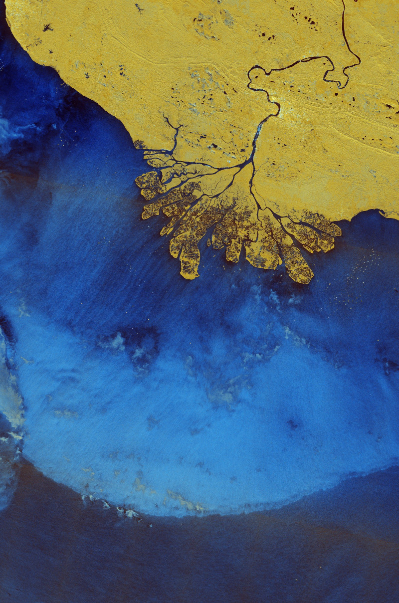
East Kalimantan, Borneo
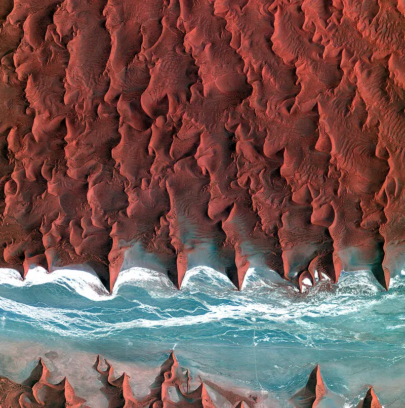
Namib Desert, Namibia
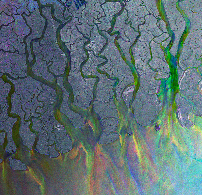
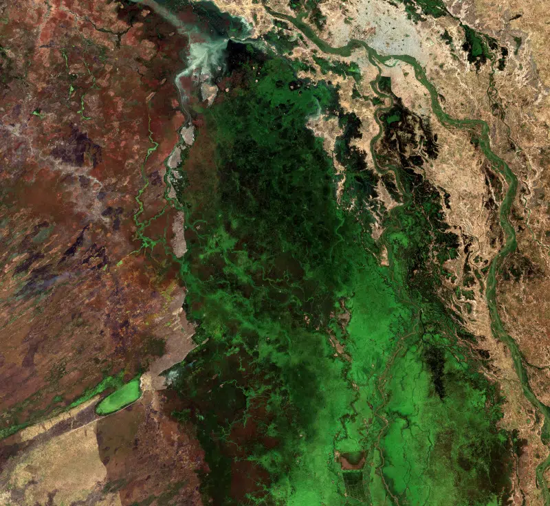
Ganges’ dazzling delta
These photos allow us to marvel at the wonders of the world from a fresh, celestial perspective.
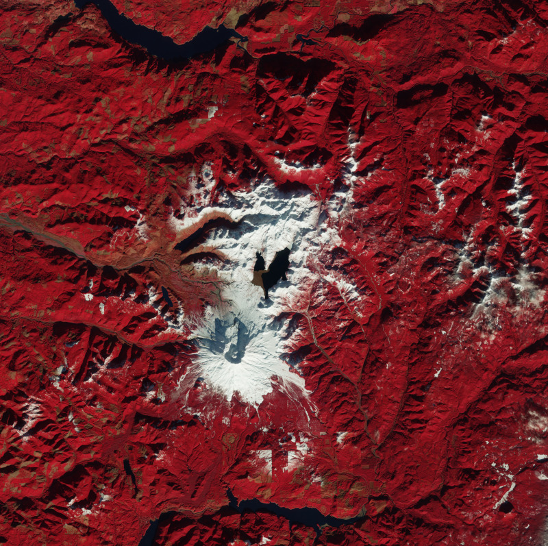
Heart of Mount St. Helens (Processed using a combination of spectral bands to highlight vegetation in red)
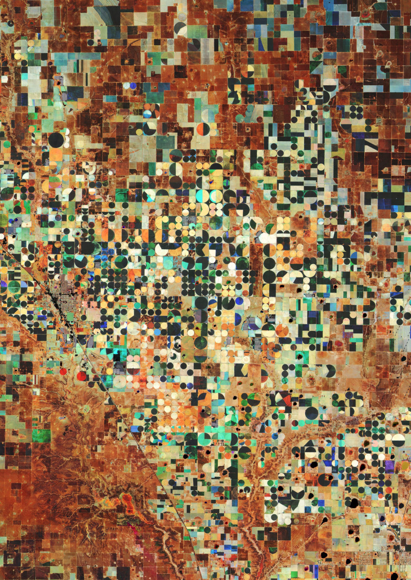
Hereford, Texas
These satellite images have been taken by Earth observation missions Copernicus Sentinel-1, Copernicus Sentinel-2, and Copernicus Sentinel-3—all developed and operated by the ESA.

Mississippi River Delta
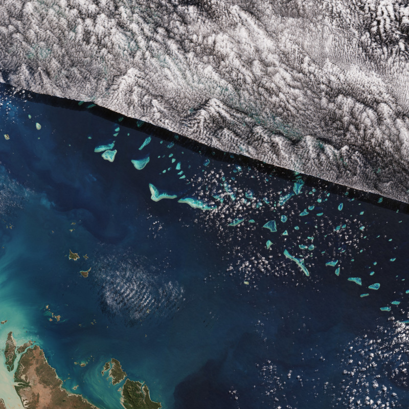
Great Barrier Reef, Australia
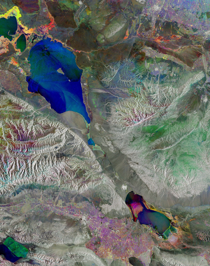
Alakol, the multicolored lake
Fitted with suite of cutting-edge instruments, these missions take high-resolution images of the Earth's surface to monitor large-scale global dynamics.
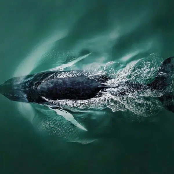
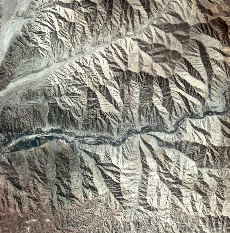
Land of giants
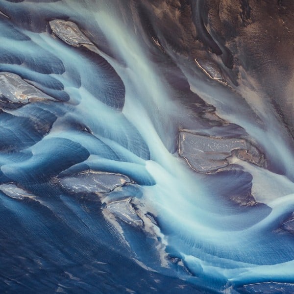
Peruvian landscape
Luckily, at the same time, they have also provided us with breathtaking sights.

Grand Bahama Island
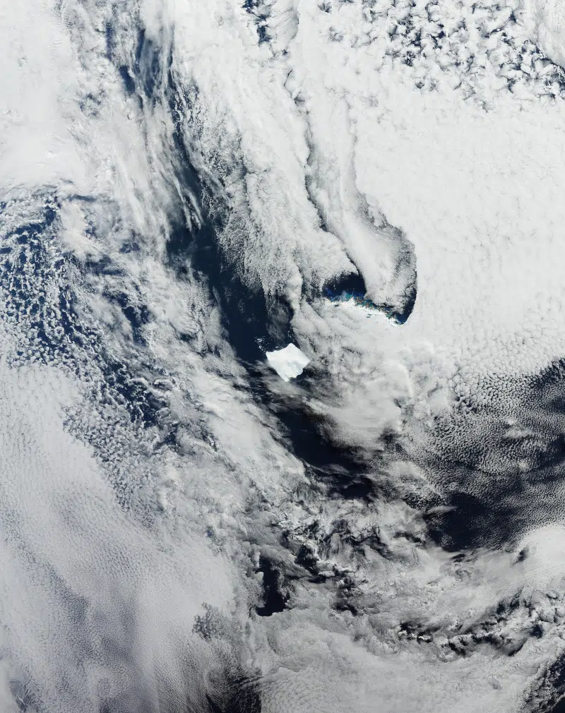
World's biggest iceberg

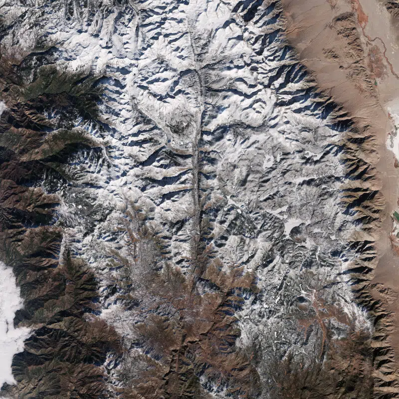
Snow-capped Swiss Alps
Mother Nature is an artist, and these images are the ultimate proof.
Waza National Park, Cameroon
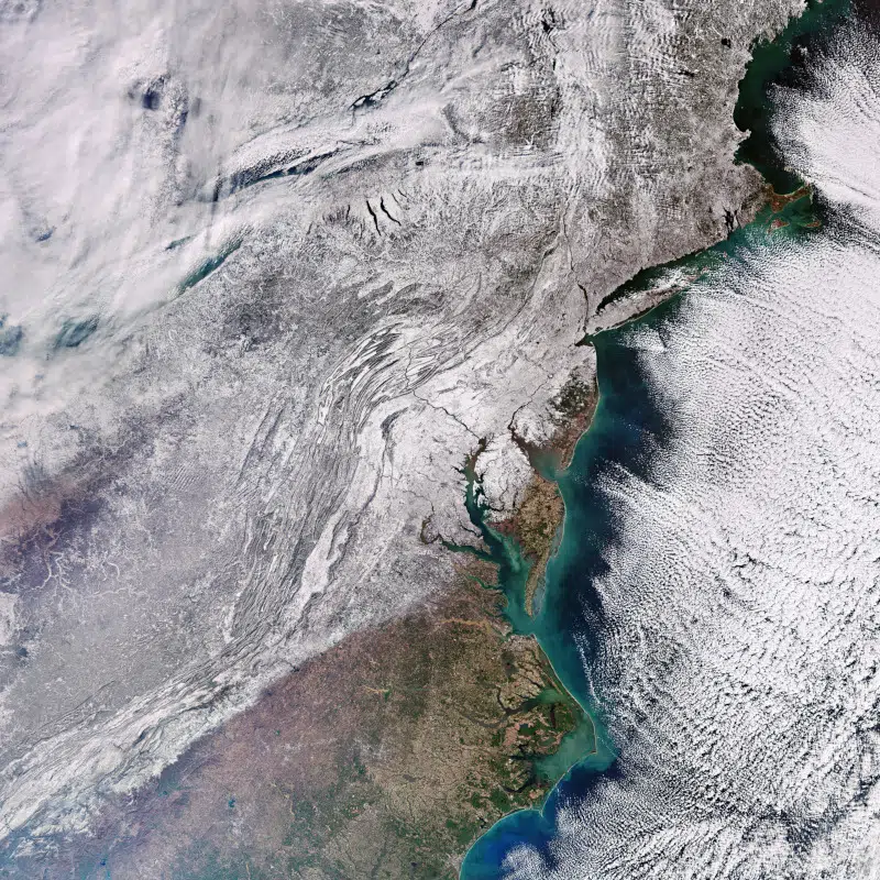
Snow-bound Eastern US
Sources: Earth from Space: East Kalimantan, Borneo; Earth from Space: Hereford, Texas; Earth from Space: Namib Desert; Earth from Space: World’s biggest iceberg; Earth from Space: the Great Barrier Reef; Earth from Space: Waza National Park, Cameroon: Earth from Space: Alakol, the multicoloured lake; Earth from Space: Land of giants; Earth from Space: Heart of Mount St Helens; Earth from Space: Peruvian landscape; Earth from Space: Grand Bahama Island; Earth from Space: Snow-capped Swiss Alps; Ganges' dazzling delta; Earth from Space: Mississippi River Delta; Earth from Space: Snow-bound eastern US
Related Articles:
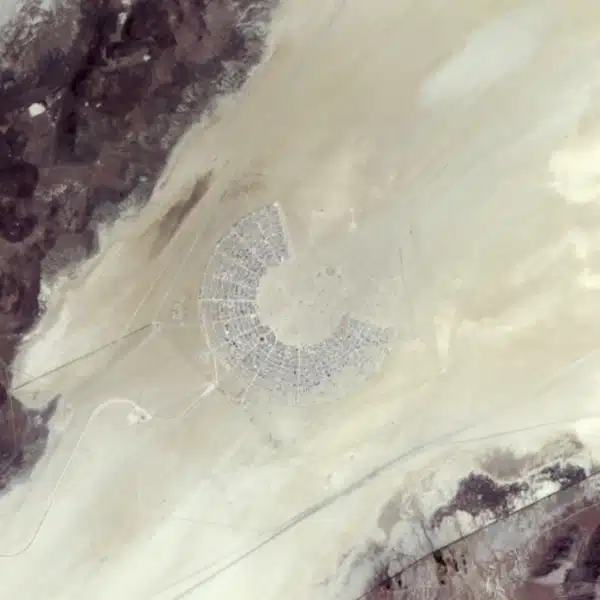
Amazing ESA Photo Shows What Burning Man Looks Like From Space
NASA Celebrates Hubble Space Telescope’s 35th Anniversary With New Photos
NASA Unveils Historic Photos of a Lunar Sunset Captured by the Blue Ghost Lander
Incredible Winners of 2024 NASA Photographer of the Year Awards